
A Glimpse into 1855 |
Rediscovering Hampden County Through an Incredible Vintage Map |
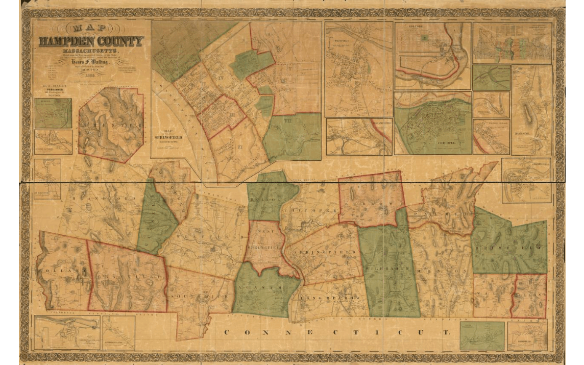 |
Western Massachusetts has always been a place where history feels close at hand—if you know where to look. For those of us in the 413, few things capture that better than stumbling across a beautifully detailed old map that shows our towns, rivers, and neighborhoods as they existed nearly 170 years ago.
Enter the 1855 Map of Hampden County, Massachusetts, surveyed and drawn by Henry Francis Walling and published in Boston by H.A. Haley. This massive hand-colored cadastral wall map (roughly 84 x 166 cm when fully spread out) is a true treasure, now preserved by the Library of Congress. It offers a snapshot of our region right in the middle of the 19th century—when factories were rising along the Connecticut River, railroads were transforming travel, and family farms still defined much of the landscape. |
 |
 |